Cottonwood Pass (from Buena Vista)
Colorado
Gradient by colour: under 3% 3–6% 6–9% 9%+
Stats computed from OpenStreetMap and satellite elevation data — approximate.
Cottonwood Pass (from Buena Vista) is a 30.9 km cycling climb averaging 4.1% (+1262 m), rising from 2432 m to 3694 m in Colorado.
The highest fully paved mountain pass in the United States since the west side was surfaced in 2019: 12,126 feet on the Continental Divide, edging out neighbouring Independence Pass by 31 feet. It began as an 1877 toll road to the silver camps, and the USA Pro Cycling Challenge crossed it on dirt in 2011.
 Zephyrnthesky
 Roy Luck
 David Herrera from Albuquerque, NM, Bernalillo
 David Herrera from Albuquerque, NM, Bernalillo
Loading rider experiences…
Download GPX
Navigate to the foot
Where it bites
Steepest 500 m: 9.7% (km 19.7–20.1).
Road: paved throughout
What it’s like to ride
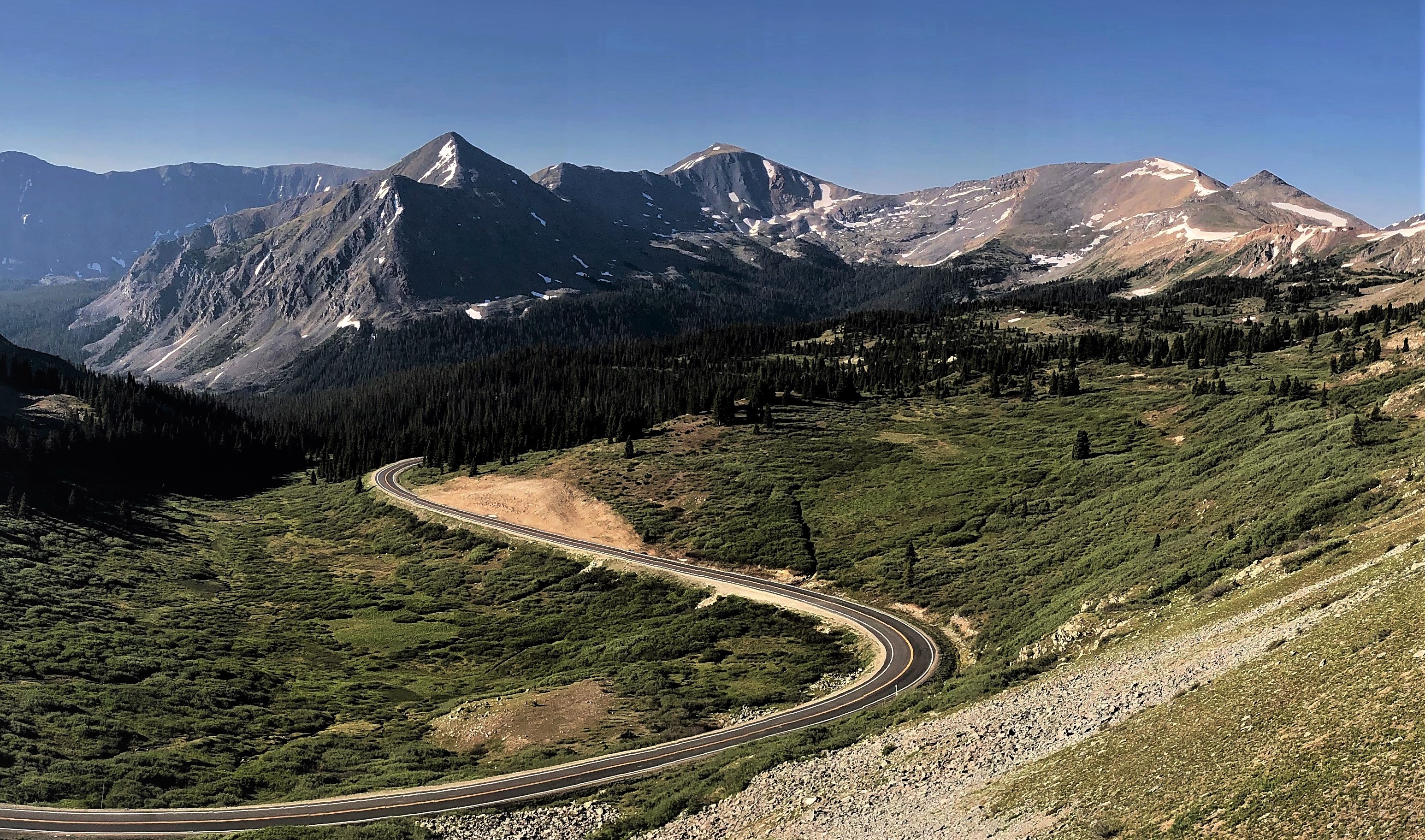
From downtown Buena Vista the first five miles are nearly flat, and the road only starts climbing in earnest past Cottonwood Hot Springs at mile 5.4, winding up through heavy tree cover on smooth pavement with no shoulder but little traffic. The real work comes after the Denny Creek trailhead around mile 12, where the grade rears to 10% and the steepest quarter mile holds over 9%. You break above tree line near mile 18, and the road swings through one big switchback and a final hairpin across bare mountainside to the top. The summit is the Continental Divide at 12,126 feet, with Ice Mountain and the Three Apostles to the north, Taylor Park spread out below to the west, and the sawtooth Ellingwood Ridge of La Plata to the southeast. There is no café or water anywhere on the climb, nothing beyond pit toilets in the campgrounds, so carry everything from town and save something for the fast, switchbacked descent home.
History
The road over Cottonwood Pass began as a miners' route: planning for a wagon road started in 1875, the first toll road opened in 1877, and in March 1880 the Buena Vista, Aspen City and White River Toll Road Company was chartered to carry traffic from Buena Vista over the pass toward the silver camps of Taylor Park and Aspen; that trade faded once the railroad reached Aspen in 1887. The west side then stayed gravel for over a century, and on 24 August 2011 the USA Pro Cycling Challenge crossed it that way: stage 2 from Gunnison to Aspen sent the peloton up nearly 14 miles of dirt to the race's high point at 12,126 ft before dropping down the paved Buena Vista side, where riders were reported at around 70 mph near the Denny Creek trailhead; George Hincapie won the stage in Aspen. When the west side was finally paved and the east side resurfaced in late 2019, Cottonwood Pass became the highest fully paved mountain pass in the United States at 12,126 ft, edging out nearby Independence Pass at 12,095 ft. That distinction, plus consistently good pavement on the Buena Vista side, is what turned the climb into a road-cycling destination in its own right.
Common questions
- How long and steep is Cottonwood Pass (from Buena Vista)?
- Cottonwood Pass (from Buena Vista) is a 30.9 km cycling climb averaging 4.1% (+1262 m), rising from 2432 m to 3694 m in Colorado.
- Where is Cottonwood Pass (from Buena Vista) steepest?
- The steepest 500 m averages 9.7%, between km 19.7 and km 20.1 of the climb.
- How many hairpins does Cottonwood Pass (from Buena Vista) have?
- Cottonwood Pass (from Buena Vista) has 8 hairpin bends, counted from the road's map geometry (a hairpin here means at least 150 degrees of turning completed within 150 metres of road). Painted corner numbers on some climbs count gentler bends too, so the two figures can differ.
- What is the road surface like on Cottonwood Pass (from Buena Vista)?
- Cottonwood Pass (from Buena Vista) is paved throughout.
30.9 km · +1262 m · 4.1% avg · ~9.7% max · 2432 → 3694 m · 8 hairpins