Mount Blue Sky (from Echo Lake)
Colorado
Gradient by colour: under 3% 3–6% 6–9% 9%+
Stats computed from OpenStreetMap and satellite elevation data — approximate.
Mount Blue Sky (from Echo Lake) is a 23.3 km cycling climb averaging 4.5% (+1070 m), rising from 3268 m to 4313 m in Colorado.
The highest paved road in North America, topping out at 14,130 feet, and the American reference test for racing at altitude: the hill climb first run in 1962, renamed for its five-time winner Bob Cook, draws up to a thousand riders a year. Tom Danielson's 1:41:20 has stood since 2004.
 Clyde Charles Brown
 Ken Gallager
 Daniel Schwen
 David Zhang
Loading rider experiences…
Download GPX
Navigate to the foot
Where it bites
Steepest 500 m: 7.0% (km 20.5–20.9).
Road: paved throughout
What it’s like to ride
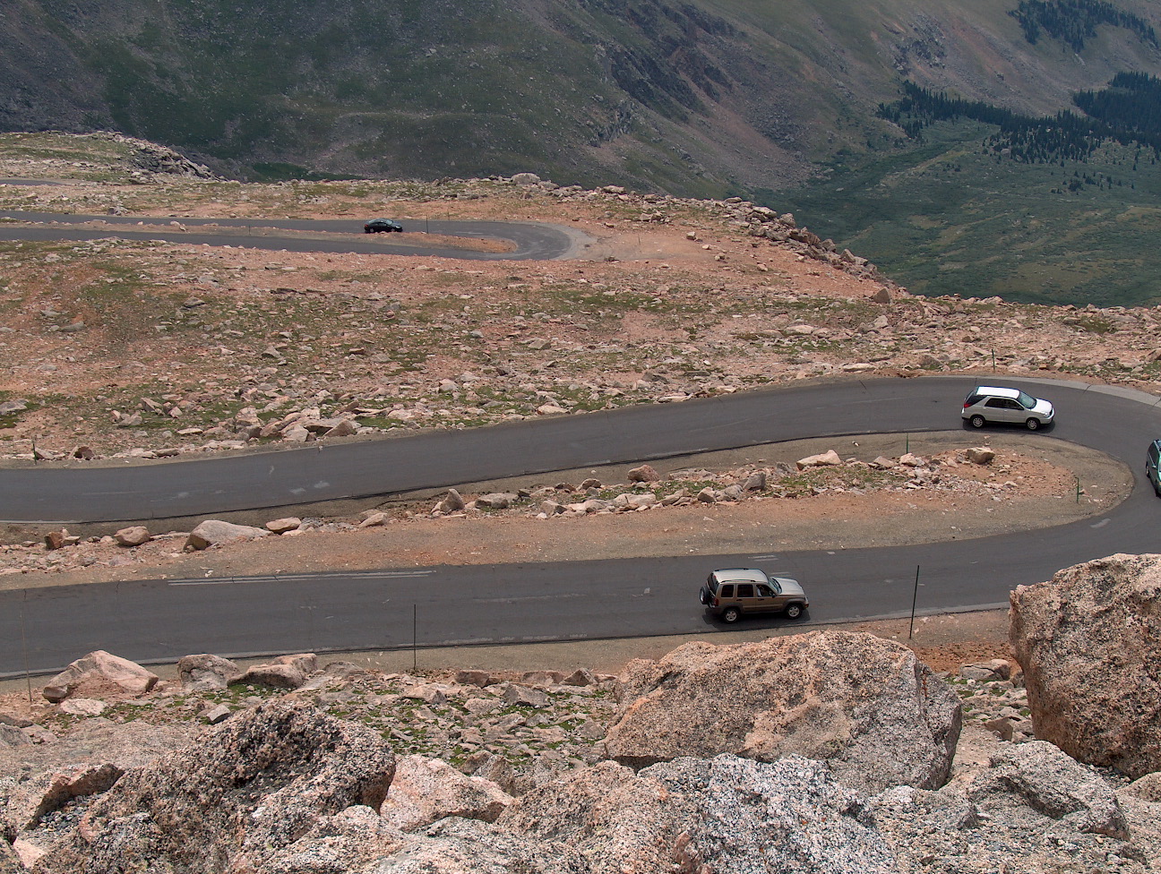
From Echo Lake the gradient never turns vicious (it holds around 4–5% almost the whole way), but the altitude does the work instead: the trees quit a few miles up and you're riding open tundra toward a summit with 42% less oxygen than sea level. A short downhill drops you to Summit Lake, where mountain goats and bighorn sheep hang around the upper miles, and then comes the hard part: the last five-plus miles stack up through roughly a dozen hairpins you can count back down from the top. Keep one eye on the tarmac: expansion joints run like linear ruts along much of the upper road, and past Summit Lake it breaks into cracks, holes and frost heaves that matter far more on the descent. The road tops out at 14,130 feet, the highest paved road in North America, at a parking lot with a restroom, the ruins of the Crest House (a restaurant until it burned in 1979, now an observation platform) and a short scramble to the true summit. There's no potable water on the mountain above Echo Lake, so carry everything you'll drink, and aim to be off the top before the afternoon thunderstorms; even in summer it sits in the 40s Fahrenheit up there.
History
The road up Mount Blue Sky (called Mount Evans until the peak was renamed in 2023) was built between 1923 and 1930 as part of the Denver Mountain Parks system, conceived partly to compete with Pikes Peak for tourist traffic, and the full route opened in 1931 as the highest road in the world at the time. Highway 5, the seasonal stretch from Echo Lake to the summit at 14,130 feet, remains the highest paved road in North America. Cyclists have raced it since 1962, when the Mount Evans Hill Climb was first run from Idaho Springs: 27.4 miles and some 6,590 feet of gain, finishing 130 feet below the summit; in 1981 the race was renamed the Bob Cook Memorial after its five-time winner, who died of cancer at 23, and in 2024 it became the Blue Sky Hill Climb. Tom Danielson set the men's course record of 1:41:20 in 2004, and Jeannie Longo of France set the women's mark of 1:59:19 in 1998. Drawing between six hundred and a thousand riders a year, the race made the climb the reference test for racing at altitude in the United States.
Common questions
- How long and steep is Mount Blue Sky (from Echo Lake)?
- Mount Blue Sky (from Echo Lake) is a 23.3 km cycling climb averaging 4.5% (+1070 m), rising from 3268 m to 4313 m in Colorado.
- Where is Mount Blue Sky (from Echo Lake) steepest?
- The steepest 500 m averages 7.0%, between km 20.5 and km 20.9 of the climb.
- How many hairpins does Mount Blue Sky (from Echo Lake) have?
- Mount Blue Sky (from Echo Lake) has 14 hairpin bends, counted from the road's map geometry (a hairpin here means at least 150 degrees of turning completed within 150 metres of road). Painted corner numbers on some climbs count gentler bends too, so the two figures can differ.
- What is the road surface like on Mount Blue Sky (from Echo Lake)?
- Mount Blue Sky (from Echo Lake) is paved throughout.
23.3 km · +1070 m · 4.5% avg · ~7.0% max · 3268 → 4313 m · 14 hairpins