Trouée d'Arenberg
Roubaix
Elevation is drawn to the same scale on every segment, so a level sector looks level. The bands beneath the line are surface, not gradient.
Route and surface read from OpenStreetMap, elevation from satellite data — approximate.
Trouée d'Arenberg is a 2.3 km cobbled sector in Roubaix, essentially level (+0 m over its full length). It is cobbled throughout.
The most famous sector of Paris-Roubaix: five stars, 2.3 straight kilometres of Napoleonic pavé through the Wallers forest, proposed by Jean Stablinski, who had worked the mine beneath it and said he was the only rider to have passed both over and under this road. Raced since 1968, and the saying has held for decades: you cannot win Roubaix here, but you can lose it.
 Jack Thurston, CC BY-SA 2.0
 FrDr, CC BY-SA 4.0
 Jack Thurston, CC BY-SA 2.0
 JÄNNICK Jérémy, Public domain
 FrDr, CC BY-SA 4.0
 Pierre André Leclercq, CC BY-SA 4.0
Loading rider experiences…
Download GPX
Navigate to the start
History
The Drève des Boules d'Hérin was cobbled in the Napoleonic era and later undermined by the Arenberg coal pit that runs beneath the forest, which is how the road reached Paris-Roubaix: Jean Stablinski, who had worked in that mine before turning professional and liked to say he was the only rider to have passed both over and under it, proposed it with Édouard Delberghe after Jacques Goddet sent Albert Bouvet looking for cobbles to replace the sectors being tarmacked, and it was raced for the first time in 1968, Pierre Chany naming it the Trouée that same day. The Office National des Forêts closed the passage from 1974 to 1983. The crashes that fixed its reputation came later: Johan Museeuw shattered his kneecap here in 1998 while leading the World Cup and came close to losing the leg to gangrene, which prompted the organisers to run the sector in the opposite direction in 1999 to cut entry speed, for one edition; Philippe Gaumont broke his femur at the entry in 2001 and never raced at that level again. Subsidence from the old workings took it out of the race in 2005, after which regional and local authorities spent 250,000 euros resetting the surface and widening it by 50 cm, and it returned in 2006. It carries five stars in the roadbook, the maximum, alongside Mons-en-Pévèle and the Carrefour de l'Arbre, and it survives only because it is worked on: Les Amis de Paris-Roubaix, volunteers since 1977, reset the stones and replace the ones souvenir hunters carry off, students from the Raismes horticultural school have spent two weeks restoring sectors here every spring since 2002, and a herd of goats was brought in to graze the verges in 2023. A stele to Stablinski has stood at the entrance since 2008, and the chicane installed in front of it for 2024 at the riders' union's request was dropped for 2025 in favour of a slower run-in with four right-angle turns through the old mining site.
What it’s like to ride
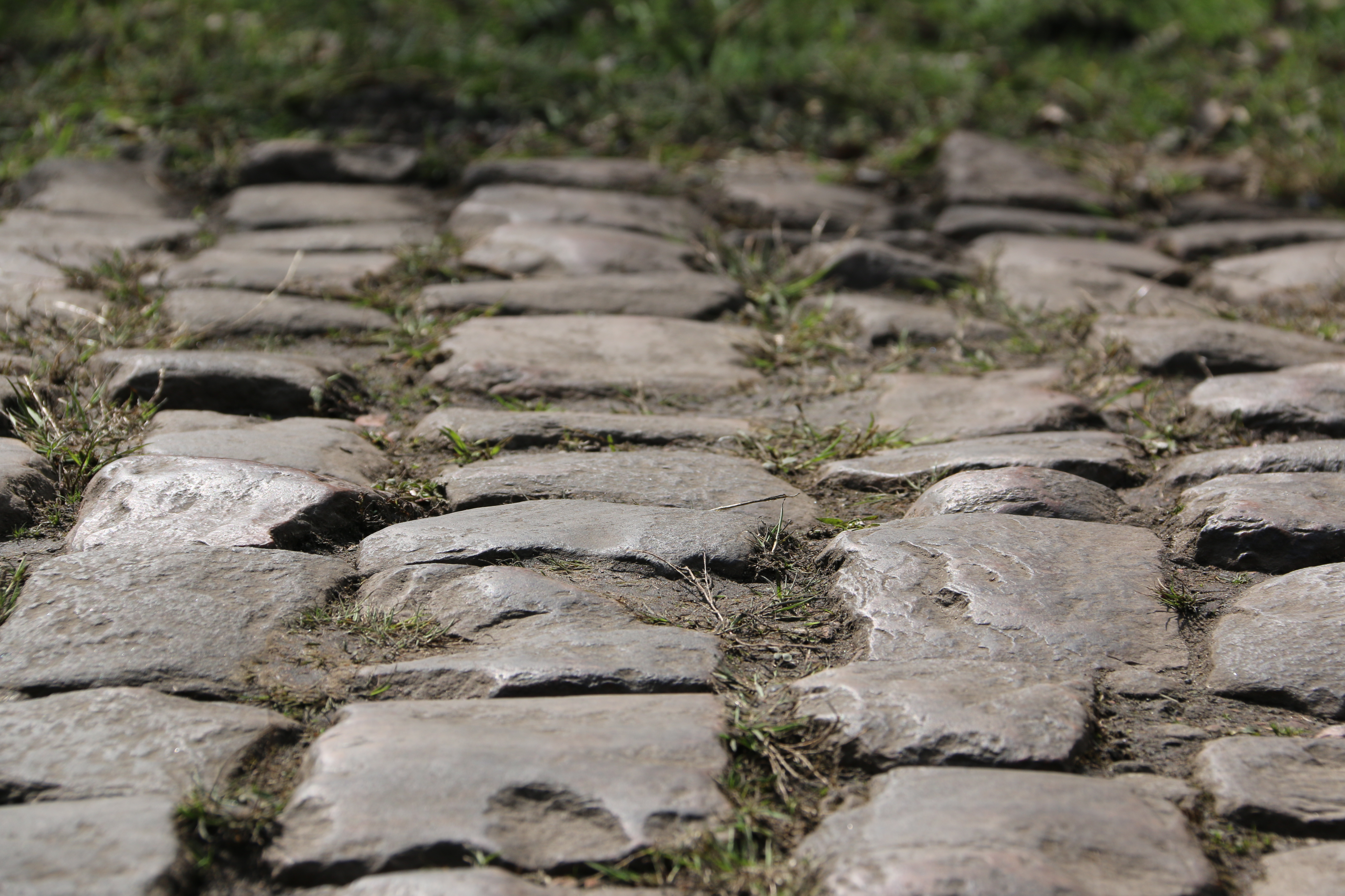
Two and a bit kilometres of arrow-straight pavé through the forest of Raismes-Saint-Amand-Wallers, three metres wide, and the worst-maintained cobbles in the race. The stones are roughly cut with grooved tops and laid out of line, and the gaps between some of them will take a fist or a bidon; the road falls gently for the first half then drags upward for the second, which is where it starts to cost you. There is no gutter, so it is either the crown in the middle where the stones sit tightest or the strip of dirt at the very edge, and on race day barriers close off the footpaths either side so nobody can escape onto them. Speed is what makes it rideable: the professionals arrive at close to 60 km/h off a straight, slightly falling tarmac run-in, and at amateur pace you sink into the stones and take the beating for longer, which is why 32 mm is now the race standard and people riding it for fun go 35 to 40. Under the trees it stays damp even when the rest of the route is dry, moss in winter, grass in summer and rotting leaves in autumn, and wet Arenberg is the slickest surface of the day. This is one that genuinely hurts, a five-star sector where the usual line is that you cannot win Roubaix here but you can lose it; a gate keeps cars out and lets bikes through, so you can go and ride it on any ordinary day.
Surface and what to expect
Cobbled throughout.
Cobbleskm 0.0–2.3
Common questions
- How long is Trouée d'Arenberg?
- Trouée d'Arenberg is a 2.3 km cobbled sector in Roubaix, essentially level (+0 m over its full length). It is cobbled throughout.
- What is the surface like on Trouée d'Arenberg?
- Trouée d'Arenberg is cobbled throughout, measured from OpenStreetMap surface tags along the route.
- Is Trouée d'Arenberg flat?
- Effectively, yes. It gains 0 m across 2.3 km — an average of 0.7%.
2.3 km · level · 2.3 km cobbled