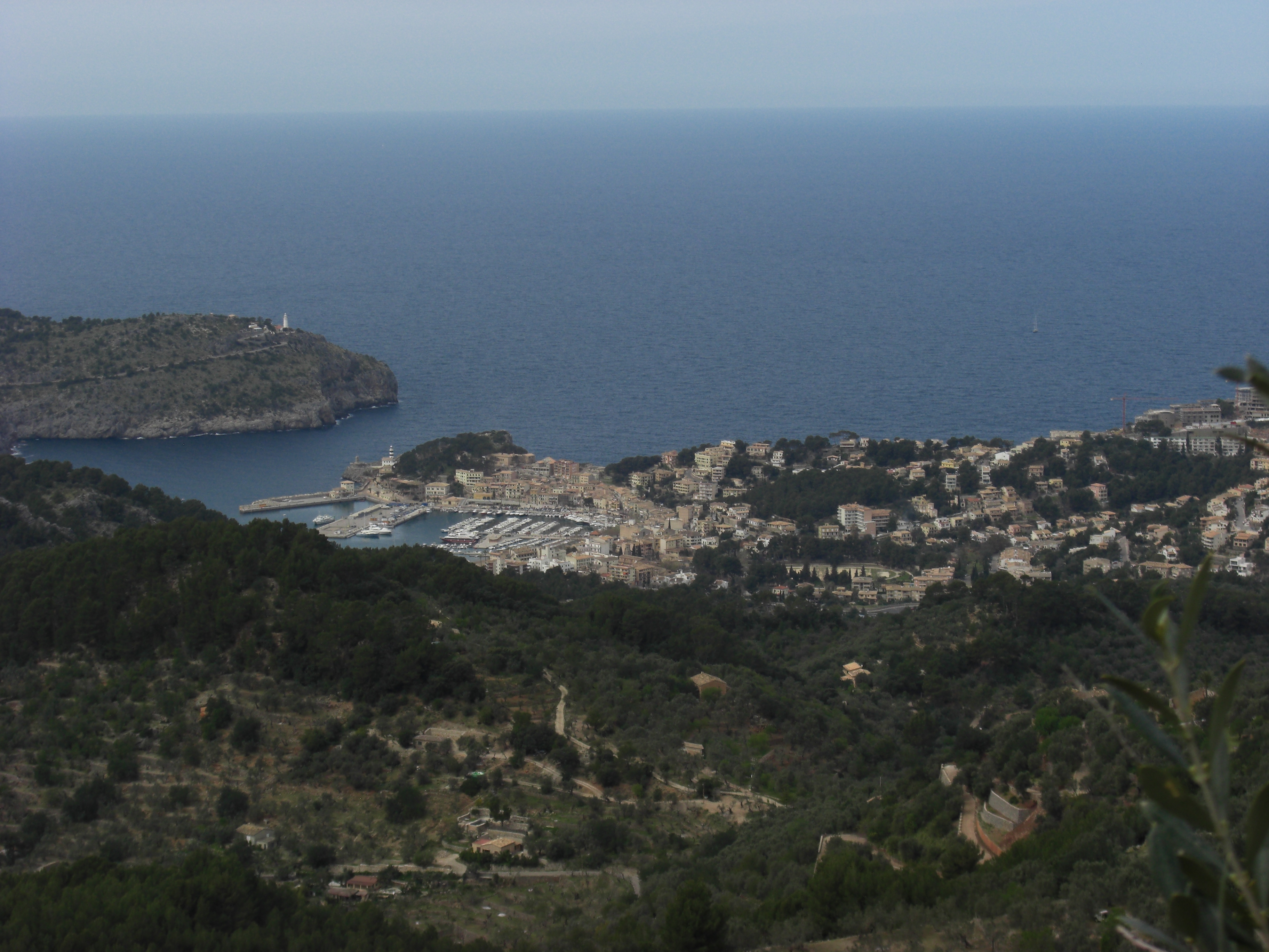
Cycling stops in Mallorca

42 places · 10 routes · Spain

Every spring the Serra de Tramuntana turns into Europe's training ground: Sa Calobra, Puig Major, the lighthouse road to Formentor. Between the climbs sit the things that make the island more than a wattage test: Roman bridges, springs, summits, and café stops with more carbon leaning outside than chairs inside.

The cafés cluster where the climbs do, between Caimari and Lluc. Sa Ruta Verda is down in the village, the Garage Café marks the top of the Coll de sa Batalla, and Es Guix sits on the old estate above it.

The Tramuntana is the island

Almost everything worth riding to sits in one limestone range along the north-west coast, and the Ma-10 runs the length of it. That concentration is why a week here works: Sa Calobra, the Coll de sa Batalla and the Puig Major road are close enough to string together, and the flat interior is a way home rather than a destination.

The two roads people come for were built by the same man. Antonio Parietti cut the switchbacks down to Sa Calobra, and in 1925 he engineered the road out to the Formentor lighthouse on the opposite coast. Neither was built for cyclists, which is most of their charm: they exist because somebody had to reach a port and a light.

Where the coffee is

The good stops are clustered rather than spread, and the cluster is Caimari to Lluc. Sa Ruta Verda in Caimari was a derelict building a former London banker rebuilt himself in 2014; Es Guix sits on a former estate above it with a pool below the terrace that riders treat as part of the reward; the Garage Café marks the top of the Coll de sa Batalla. You can hit all three on one climb.

Height is the other pattern. Ca'n Topa is at just under 500 metres, about as high as a café gets on this island, and its winter tables fill with professional teams on camp. Cycling Planet near Alaró is run by David Muntaner, who won Madison gold at the 2014 World Championships and rode two Olympics for Spain; the furniture is boards lifted from the Palma velodrome when it was resurfaced.

What else is up there

The sanctuary at Lluc has been on its hill since a hermitage went up in 1317, and it is still the natural place to break a Tramuntana day. Above it, Massanella is the island's highest peak you are allowed to walk up, which is a distinction worth knowing before planning a rest day around Puig Major.

On the west coast the terraces at Banyalbufar are visible from the road: roughly two thousand dry-stone marjades stacked from the Ma-10 nearly to the cliffs, cut by Moorish engineers and still fed by one connected system of stone aqueducts and cisterns.

The flat half

The Pla is the flat middle you cross to reach the mountains: quiet field roads between villages three or four kilometres apart, and the things worth stopping at there are older than anything in the Tramuntana: the Roman city of Pollentia at Alcúdia, the walled talaiotic settlement of ses Païsses near Artà, the archaeology museum at Son Fornés.

Palma is a ride start rather than a destination, but it holds the two buildings most people photograph without stopping: the cathedral on the seafront and the Almudaina palace beside it. The Miró foundation is up the hill in Cala Major, and the Rapha clubhouse on Plaça del Rosari is where a lot of group rides form.

Start here

Sa Ruta VerdaCaféA cycling cafe and shop in Caimari, at the foot of the Coll de sa Batalla climb.Es Coll de sa Batalla (Garage Café)Food stopA café-restaurant next to the Repsol garage at the top of Coll de sa Batalla.Es GuixFood stopA terrace built into the rock over a natural pool, on the road up Coll de sa Batalla.Santuari de LlucLandmarkSantuari de Lluc is Mallorca's leading pilgrimage site, a monastery built around a stone image of the Virgin Mary said to have been found here in 1229 and ve…Far de FormentorAttractionThe highest lighthouse in the Balearic Islands, 210 m above the sea, at the tip of Cap de Formentor.Puig de MassanellaPeak · 1364.90 mMallorca's second-highest peak, and the highest one open to hikers since Puig Major turned military in 1958.Banyalbufar TerracesLandmarkThese dry-stone terraces (marjades) above Banyalbufar were cut into the coastal slopes by Moorish farmers in the 10th–11th century, along with an aqueduct ir…Castell d'AlaróLandmarkCastell d'Alaró is a ruined medieval fortress atop the 821 m Puig d'Alaró in the Tramuntana mountains, first recorded as a stronghold in 902.Cycling PlanetCaféCycling Planet is a bike shop, workshop, and café on Alaró's main street, run since 2012 by former track cycling world champion David Muntaner and his wife L…Ciutat romana de PollèntiaArchaeological siteRoman city on Alcúdia's edge, founded in 123 BC by consul Quintus Caecilius Metellus Balearicus.La Seu CathedralLandmarkPalma's Gothic cathedral, built where the city's mosque stood before the 1229 conquest.

Cafés

Ca s'AmitgerCaféRestaurant at the edge of Lluc monastery's car park, round in shape and known as the bar redó.Ca'n TopaCaféCafé-bar at the top of the Coll de Sóller, between Bunyola and Sóller.Club PollençaCafé · PollençaA café and cultural club on Pollença's Plaça Major, grown from a 1910 cycling club founded across the square.Cycling PlanetCaféCycling Planet is a bike shop, workshop, and café on Alaró's main street, run since 2012 by former track cycling world champion David Muntaner and his wife L…Doble CoffeeCaféA specialty coffee shop on Esporles' plane-tree avenue, named for its founders' double shot.Es VergerCaféA mountain restaurant on the climb below Castell d'Alaró, above Alaró in the Serra de Tramuntana.Rapha Clubhouse MallorcaCaféRapha's cycling clubhouse and café, on Plaça del Rosari just north of Palma's cathedral.S'AturadaCaféA village bar-and-grill in Caimari, on the road up to Lluc and Coll de sa Batalla.Sa Ruta VerdaCaféA cycling cafe and shop in Caimari, at the foot of the Coll de sa Batalla climb.

Food

Ca N'AntunaFood stopThe oldest restaurant in Fornalutx, run by the same family for 50 years.Es Coll de sa Batalla (Garage Café)Food stopA café-restaurant next to the Repsol garage at the top of Coll de sa Batalla.Es GuixFood stopA terrace built into the rock over a natural pool, on the road up Coll de sa Batalla.La CalobraFood stopThe self-service restaurant at the foot of Sa Calobra's hairpin road, above the cove.Mirador de ses BarquesFood stopA terrace above Port de Soller, built in 1961 purely as a viewpoint over the bay.Tolo's Bar & RestaurantFood stopA seafront bar-restaurant on Port de Pollença's promenade, open since 1985.

Climbs, views & nature

Banyalbufar TerracesLandmarkThese dry-stone terraces (marjades) above Banyalbufar were cut into the coastal slopes by Moorish farmers in the 10th–11th century, along with an aqueduct ir…Castell de la Punta de n'AmerViewpointA sandstone watchtower on the headland of Punta de n'Amer, built in 1693.Coves del DrachLandmarkA live string quartet plays classical music from boats on Llac Martel, one of the largest underground lakes in the world, at the end of an hour-long walk thr…Puig de MassanellaPeak · 1364.90 mMallorca's second-highest peak, and the highest one open to hikers since Puig Major turned military in 1958.Puig de RandaPeak · 540 mA 543 m summit crowned by the Sanctuary of Cura, reached past two more hermitages on the road up from Randa.Puig MajorPeak · 1436 mThe highest mountain on Mallorca, its summit closed off by a military radar station.Puig TomirPeak · 1104 mThe highest peak in the northern Serra de Tramuntana, near Lluc, at 1,103 m.

History & landmarks

AjuntamentHistoric site · PalmaPalma's town hall on Plaça de Cort, under a baroque façade topped by a 3-metre stone cornice.Banc de SóllerBuilding · SóllerThis modernist facade on Sóller's central Plaça de la Constitució was rebuilt in 1910–1912 by Joan Rubió i Bellver, a disciple of Antoni Gaudí, giving the sq…Cases de NeuAttractionCases de Neu are the ruins of snow houses in the Coma de n'Arbona pass, high in Mallorca's Serra de Tramuntana.Castell d'AlaróLandmarkCastell d'Alaró is a ruined medieval fortress atop the 821 m Puig d'Alaró in the Tramuntana mountains, first recorded as a stronghold in 902.Castell de BellverLandmarkRound Gothic castle on a hilltop above Palma de Mallorca, one of only four in Europe with a circular plan.Castell de BendinatCastleNeo-Gothic castle built in the 1860s over an Islamic-era farm estate on Mallorca's west coast.Castell de CapdeperaCastleA walled hilltop fortress above Capdepera, built from 1300 against pirate raids.Ciutat romana de PollèntiaArchaeological siteRoman city on Alcúdia's edge, founded in 123 BC by consul Quintus Caecilius Metellus Balearicus.Coves de l'AlzinaretArchaeological siteMallorca's most important prehistoric burial site: eight Bronze Age rock-cut chambers above Cala Sant Vicenç.Coves dels HamsAttractionA cave system near Portocristo, named for the hook-shaped stalactites found inside in 1905.Far de FormentorAttractionThe highest lighthouse in the Balearic Islands, 210 m above the sea, at the tip of Cap de Formentor.Fonts UfanesAttractionAn intermittent spring that bursts up from the ground after heavy rain over Puig Tomir.FornalutxLandmarkFornalutx is a stone-built village high in the Serra de Tramuntana above Sóller, founded as an Arab farmstead and ringed by orange and lemon groves.Fundació Pilar i Joan Miró a MallorcaMuseum · PalmaJoan Miró's home and studios for almost 30 years, kept much as he left them, now holding 6,000 of his works.La Seu CathedralLandmarkPalma's Gothic cathedral, built where the city's mosque stood before the 1229 conquest.Palau de l'AlmudainaCastleRoyal palace facing Palma Cathedral, built over a Muslim fortress and still an official royal residence.Platja d'es TrencAttraction10 km beach of white sand between Sa Ràpita and Colònia de Sant Jordi, backed by working salt pans.poblat talaiòtic de ses PaïssesArchaeological siteBronze Age talayotic settlement on Artà's southeastern outskirts, among the Balearic Islands' best-preserved prehistoric sites.Pont RomàBridgeA medieval stone bridge over the Torrent de Sant Jordi, at the gate to Pollença's Ternelles valley.Santuari de LlucLandmarkSantuari de Lluc is Mallorca's leading pilgrimage site, a monastery built around a stone image of the Virgin Mary said to have been found here in 1229 and ve…

Climbs

Cap de Formentor (Mirador d'es Colomer)3.3 km · 5.5%Coll d'Orient6.2 km · 4.4%Coll de Femenia11.9 km · 3.9%Coll de sa Batalla9.0 km · 4.4%Coll de sa Gramola (from Andratx)5.7 km · 4.8%Coll de Sóller7.3 km · 4.4%Puig de Randa (Santuari de Cura)5.0 km · 4.8%Puig Major (from Sóller)15.9 km · 5.4%Sa Calobra10.1 km · 6.6%Santuari de Sant Salvador (Felanitx)5.2 km · 6.1%
CLIMB

Puig Major (from Sóller)

Mallorca

Gradient by colour: under 3% 3–6% 6–9% 9%+

Stats computed from OpenStreetMap and satellite elevation data — approximate.

Puig Major (from Sóller) is a 15.9 km cycling climb averaging 5.4% (+864 m), rising from 21 m to 874 m in Mallorca.

The island's highest road, cut for the Cold War: the Ma-10 out of Sóller was built by about 1,000 local workers with machinery left over from the American radar station, and opened in 1961. The Challenge Mallorca races it as a first-category climb, Kwiatkowski holds the fastest recorded ascent at 33:12, and the Monnàber tunnel at 850 m is as high as a road bike gets on Mallorca.

Puig Major (from Sóller)
INDALOMANIA
Puig Major (from Sóller)
Рустам Абдрахимов
Puig Major (from Sóller)
ANKAWÜ
Puig Major (from Sóller)
INDALOMANIA
1 / 4

Loading rider experiences…

From riders

Download GPX

Navigate to the foot

Where it bites

Steepest 500 m: 12.3% (km 15.2–15.5).

Road: paved throughout

kmtoavg
111 m-1.0%
239 m3.0%
3105 m6.4%
4166 m6.2%
5236 m7.2%
6294 m5.8%
7373 m7.3%
8411 m4.1%
9480 m6.7%
10528 m4.7%
11565 m3.6%
12621 m6.0%
13681 m7.0%
14747 m5.9%
15804 m5.6%

What it’s like to ride

The Ma-10 out of Sóller sets a rhythm rather than a fight, holding around 6% for most of the way with no pitch steep enough to force you out of the saddle. The first narrow hairpin comes after about a kilometre, the road tightens, and dense pine forest closes over it; the Fornalutx turn is signposted near km 4 for water and cafés, but the village sits off the climb. Around km 6 the gradient eases and a tight turn leads up on the left to the Mirador de Ses Barques, the one proper stop on the way, with food and a terrace looking out over Port de Sóller and the coast. Above that the views disappear for a good while and the hardest stretch arrives at km 11 and 12, both averaging over 7%, before a viewpoint about 500 m from the top opens onto the Tramuntana ridge running toward a distant shoreline. The climb ends at the Túnel de Monnàber at roughly 850 m, the highest point on Mallorca you can reach on a road bike, and the tunnel is lit but a light is sensible; the Cúber reservoir appears between the rocks as you come out the far side. Nothing is sold at the tunnel itself, the road above it to the 1,436 m summit belongs to a military base and is closed to cyclists, and the next café is at Escorca by the Sa Calobra junction about 11 km on.

History

The road up from Sóller was cut for the Cold War. The Madrid Pacts of September 1953 between Spain and the United States put a NATO radar station on the summit of Puig Major, and its two domes were switched on in July 1959. The American machinery left over from that job was then reused on the road from Sa Calobra to Sóller: three years of work by about 1,000 people, most of them from Sóller, and a 17 km route with two tunnels was inaugurated on 23 July 1961. Professionals race it in the Challenge Mallorca, and in the 2024 Trofeo Serra de Tramuntana, 153.8 km from Selva to Lluc, the peloton crossed the Coll de Sóller and then took on the first-category 14.2 km Puig Major, where Aleksandr Vlasov attacked five kilometres from the top and Lennert Van Eetvelt bridged across to win the sprint at Lluc. Since 2023 the Subida a la Bola del Puig Major has timed riders from the Sóller fire station at Ma-10 km 51.5 up to the radar dome on the summit, with close to 500 taking part in 2025, won by Steven Dillen and Antònia Siquier. The fastest recorded Strava ascent of the climb belongs to Michał Kwiatkowski, 33:12.

Worth stopping near the climb

Cases de Neu1 kmBanc de Sóller1 kmPuig Major2 kmMirador de ses Barques3 kmCa N'Antuna3 km

More climbs in Mallorca

Coll de Sóller7.3 km · 4.4%Coll d'Orient6.2 km · 4.4%Sa Calobra10.1 km · 6.6%Coll de sa Batalla9.0 km · 4.4%Coll de Femenia11.9 km · 3.9%

Common questions

How long and steep is Puig Major (from Sóller)?
Puig Major (from Sóller) is a 15.9 km cycling climb averaging 5.4% (+864 m), rising from 21 m to 874 m in Mallorca.
Where is Puig Major (from Sóller) steepest?
The steepest 500 m averages 12.3%, between km 15.2 and km 15.5 of the climb.
How many hairpins does Puig Major (from Sóller) have?
Puig Major (from Sóller) has 9 hairpin bends, counted from the road's map geometry (a hairpin here means at least 150 degrees of turning completed within 150 metres of road). Painted corner numbers on some climbs count gentler bends too, so the two figures can differ.
What is the road surface like on Puig Major (from Sóller)?
Puig Major (from Sóller) is paved throughout.

Checked 13 August 2026

Elevation from SRTM (NASA) · Road line + coordinates © OpenStreetMap contributors · Story adapted from Wikipedia and cycling-media reporting, CC BY-SA 4.0 · Photos: Wikimedia Commons, credited per image

Places / Mallorca / Puig Major (from Sóller)

15.9 km · +864 m · 5.4% avg · ~11.4% max · 21 → 874 m · 9 hairpins

1%6%6%6%5%5%6%2468101214km21 m874 m

Photo: INDALOMANIA · © OpenStreetMap contributors · Sources: OpenStreetMap