Mount Lemmon (Catalina Highway)
Climb · Tucson & the Sky Islands
Checked
part of: The vertical kilometre clubpart of: Roads built as statementspart of: The climbs that never turn backpart of: Roads to the telescopes
Mount Lemmon (Catalina Highway) is a 46.3 km cycling climb averaging 3.7% (+1887 m), rising from 814 m to 2548 m in Tucson & the Sky Islands.
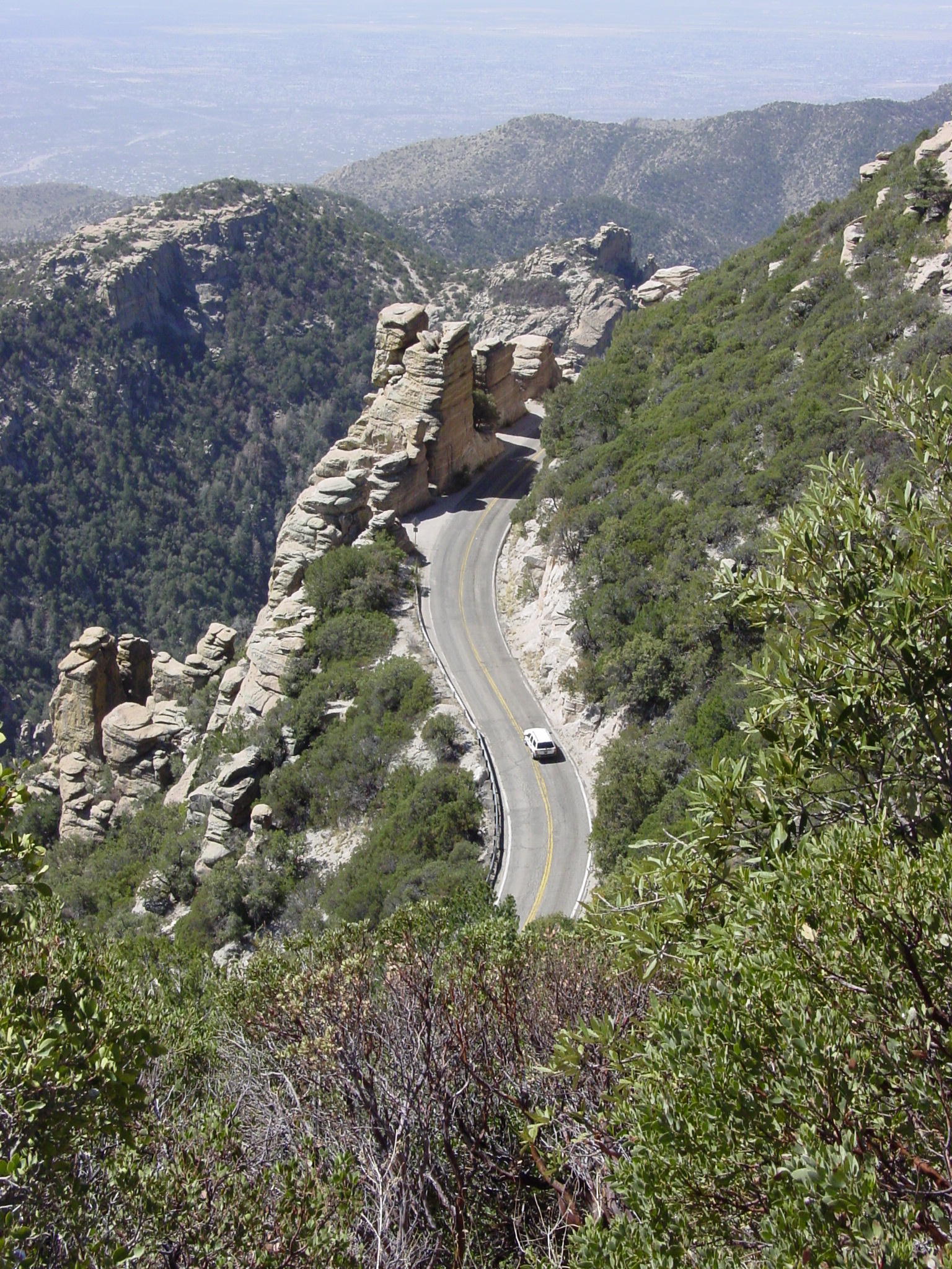
The reason most riders come to Tucson: 29 miles from saguaro to pine at a metronomic 4 to 6%, built over 17 years by a rotating workforce of nearly 8,000 federal prisoners, Gordon Hirabayashi among them. Racing arrived in 1968 and never left, and the Cookie Cabin at Summerhaven is the summit ritual.


46.3 km · +1887 m · 3.7% avg · ~9.0% max · 814 → 2548 m
Stats computed from OpenStreetMap and satellite elevation data — approximate.
Download GPX ↓Navigate to the foot ↗
Gradient by colour: ● <3% ● 3–6% ● 6–9% ● 9%+
Where it bites
Steepest 500 m: 9.0% (km 45.3–45.7).
Road: paved throughout
| km | to | avg |
|---|---|---|
| 1 | 821 m | 0.8% |
| 2 | 827 m | 0.5% |
| 3 | 840 m | 1.4% |
| 4 | 852 m | 1.7% |
| 5 | 902 m | 4.3% |
| 6 | 954 m | 5.2% |
| 7 | 1020 m | 5.6% |
| 8 | 1066 m | 4.7% |
| 9 | 1111 m | 4.3% |
| 10 | 1165 m | 5.9% |
| 11 | 1219 m | 5.3% |
| 12 | 1272 m | 5.3% |
| 13 | 1319 m | 4.7% |
| 14 | 1356 m | 4.7% |
| 15 | 1424 m | 5.7% |
| 16 | 1479 m | 5.5% |
| 17 | 1521 m | 4.9% |
| 18 | 1589 m | 6.4% |
| 19 | 1623 m | 3.1% |
| 20 | 1661 m | 3.8% |
| 21 | 1698 m | 5.0% |
| 22 | 1772 m | 6.1% |
| 23 | 1802 m | 3.0% |
| 24 | 1845 m | 4.3% |
| 25 | 1913 m | 6.6% |
| 26 | 1963 m | 5.2% |
| 27 | 2008 m | 5.1% |
| 28 | 2032 m | 2.4% |
| 29 | 2095 m | 5.9% |
| 30 | 2134 m | 3.5% |
| 31 | 2177 m | 4.9% |
| 32 | 2219 m | 4.2% |
| 33 | 2275 m | 5.5% |
| 34 | 2334 m | 5.1% |
| 35 | 2390 m | 6.2% |
| 36 | 2435 m | 4.4% |
| 37 | 2485 m | 5.5% |
| 38 | 2488 m | 0.3% |
| 39 | 2451 m | -3.3% |
| 40 | 2400 m | -5.3% |
| 41 | 2383 m | -2.4% |
| 42 | 2433 m | 3.8% |
| 43 | 2443 m | 1.2% |
| 44 | 2412 m | -2.8% |
| 45 | 2458 m | 4.7% |
| 46 | 2539 m | 8.1% |
What it’s like to ride
Most riders start from Le Buzz café at the corner of Tanque Verde and Catalina Highway, and from there it is close to 29 miles of continuous road, from saguaro forest at about 2,600 feet to above 9,000, averaging around 4.2%. The character is metronomic rather than brutal: a steady 4 to 6% almost the whole way on smooth tarmac with a wide shoulder, and mile markers posted from zero to 23 so you can tick off progress in one gear. Windy Point at mile 14.7 is where everyone stops, granite pinnacles and hoodoos on both sides, and the rock sculptures keep coming for a few more miles while the cactus gives way to pine and the air turns 20 to 30°F cooler than the town you left. Carry what you need low down, because there is no water until the Bigelow trailhead past mile marker 19. Near the top the road gives some height back, dropping 2.1 miles at 4.2% from mile 21.2 and again briefly before the right turn onto Ski Run Road, where the last 2.6 miles kick up to 8.1%. Summerhaven at the top has food and shelter, and the Cookie Cabin, open 11 to 5, sells cookies the size of a paper plate.
History
Frank Harris Hitchcock, publisher of the Tucson Citizen and a former US Postmaster General, pushed for a short road from Tucson up into the Santa Catalina high country, and work began in 1933. Federal prisoners built it: a rotating workforce of nearly 8,000 men housed at Prison Camp No. 10, later the Catalina Federal Honor Camp, who started with picks, shovels and wheelbarrows and who during the Second World War included Japanese American draft resisters, among them Gordon Hirabayashi. Construction ran 17 years and reached Summerhaven in 1950, the camp closing in 1951 once the road was done; the highway carries Hitchcock's name, given after his death in 1935. The narrow original was rebuilt between 1988 and 2007 in seven Federal Lands Highway projects worth about $15 million, adding the wider shoulders and guard rails riders use now, and the redesign won Arizona's Engineering Excellence Grand Award for Context Sensitive Design in 2005. Racing arrived on 28 April 1968, when riders from Phoenix and Tucson took on 31 miles from the edge of town to the observatory: local law enforcement halted the pack and ordered single file with no passing, the race resumed once the officers left, and Mike Keller won in 2 hours 20 minutes. The Greater Arizona Bicycling Association now runs its annual Mt. Lemmon Hill Climb up the same road, from McDonald Park to Ski Valley.
Worth stopping near the climb
More climbs in Tucson & the Sky Islands
Common questions
- How long and steep is Mount Lemmon (Catalina Highway)?
- Mount Lemmon (Catalina Highway) is a 46.3 km cycling climb averaging 3.7% (+1887 m), rising from 814 m to 2548 m in Tucson & the Sky Islands.
- Where is Mount Lemmon (Catalina Highway) steepest?
- The steepest 500 m averages 9.0%, between km 45.3 and km 45.7 of the climb.
- What is the road surface like on Mount Lemmon (Catalina Highway)?
- Mount Lemmon (Catalina Highway) is paved throughout.