Madera Canyon
Tucson & the Sky Islands
Gradient by colour: under 3% 3–6% 6–9% 9%+
Stats computed from OpenStreetMap and satellite elevation data — approximate.
Madera Canyon is a 20.9 km cycling climb averaging 3.7% (+784 m), rising from 878 m to 1655 m in Tucson & the Sky Islands.
The gentle one of Tucson's big climbs: a lumber road turned CCC-built canyon retreat, now the winter training ride the visiting professionals rank just behind Mount Lemmon. The gradient saves itself for the end, a final ramp near 15% at the road's close.
 John
John $1LENCE D00600D
 ALAN SCHMIERER
 Fredlyfish4
Loading rider experiences…
Download GPX
Navigate to the foot
Where it bites
Steepest 500 m: 10.6% (km 19.7–20.2).
Road: paved throughout
What it’s like to ride
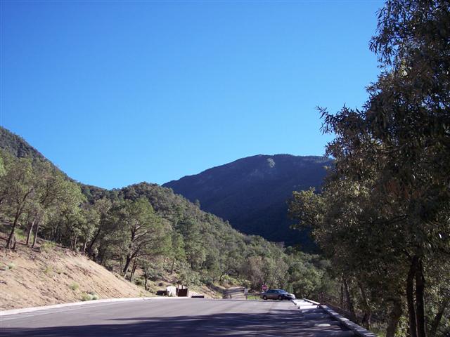
Madera Canyon climbs from the high desert grassland outside Green Valley to the end of the road at the base of Mount Wrightson, and for most of its length it barely feels like a climb: a steady couple of percent along a desert ridge with long open views, on pavement in good shape apart from expansion cracks every 15 to 20 feet that you notice far more on the way down. Then the road ducks into the canyon under sycamore and oak, and the shade and the gradient arrive together: the last few miles bite properly, with a half-mile pitch around 10% and a final ramp to the road's end at close to 15%. There is no bike lane anywhere on it, but traffic is genuinely light, which is much of why the pros who come to Tucson rank it their second or third choice after Mount Lemmon. Water and restrooms sit at the lookout about nine miles up, Santa Rita Lodge a mile and a half further on will sell you a Gatorade, and the top at 5,341 feet has restrooms, a campground and Madera Kubo. Watch the road on the descent: deer, coati, snakes and wild turkey all use it.
History
Madera is Spanish for lumber, and the canyon earned the name: a commercial lumber camp worked here in the late 1800s, and a road was cut from the canyon down to the main Tucson to Tubac road to haul the timber out. The Santa Rita Mountains became part of the new National Forest System in 1905, and from 1911 a Tucson businessman and his backers built cabins on land leased from the Forest Service. The roads were improved over the following years, automobiles came into use, and the canyon turned into a summer destination. A Civilian Conservation Corps camp worked the canyon through the 1930s, building a campground, an amphitheater, trails and erosion works, and its largest project was the Mt. Wrightson picnic area at the end of the road at about 4,500 feet, where many of the rock walls they laid still stand. That paved road is now a winter training ground for road cyclists and triathletes, a steady ascent from Green Valley to the base of Mount Wrightson that Tucson riders rank second only to Mount Lemmon among the area's climbs.
Common questions
- How long and steep is Madera Canyon?
- Madera Canyon is a 20.9 km cycling climb averaging 3.7% (+784 m), rising from 878 m to 1655 m in Tucson & the Sky Islands.
- Where is Madera Canyon steepest?
- The steepest 500 m averages 10.6%, between km 19.7 and km 20.2 of the climb.
- What is the road surface like on Madera Canyon?
- Madera Canyon is paved throughout.
20.9 km · +784 m · 3.7% avg · ~10.6% max · 878 → 1655 m