Cycling stops in Tucson & the Sky Islands

26 places · 5 routes · Arizona, United States

Tucson's reputation rests on one road. The Catalina Highway leaves the eastern edge of town at saguaro height and climbs for about forty kilometres to Ski Valley, gaining the better part of 1,800 metres and passing out of the Sonoran Desert into pine forest on the way, a change of vegetation that would otherwise take a drive to Canada. Riders stack up at Le Buzz at the bottom before the climb and at the Cookie Cabin in Summerhaven after it, which is as close as American road cycling gets to a liturgy.

The rest of the riding fans out from there: Gates Pass and the Saguaro West loop to the desert museum, the long straight run south past the Titan silo to Madera Canyon, Kitt Peak's observatory road out on the Tohono O'odham Nation, and the mission of San Xavier del Bac standing white against the desert on the way home. Two hours east, Mount Graham's Swift Trail climbs 34 km into the Pinaleños, the biggest of the sky islands and the region's longest sustained climb. It stays rideable through the winter, which is why the training camps come.

Cafés

Boca Tacos Y TequilaCaféBOCA Tacos y Tequila is a scratch-kitchen Mexican restaurant on Tucson's Fourth Avenue, run by chef Maria Mazon, a Top Chef alum and James Beard Award semifi…El CharroCaféEl Charro Café is a Mexican restaurant in downtown Tucson, run by the same family since 1922 and billed as the nation's oldest continuously operating Mexican…El Güero CaneloCaféEl Güero Canelo is a Tucson institution for Sonoran hot dogs, started in 1993 by Daniel and Blanca Contreras from a small trailer on South 12th Avenue and no…Exo Roast Co.CaféExo Roast Co.Le Buzz CaféCaféLe Buzz Caffe is a breakfast-and-lunch café with a full espresso bar that has served Tucson since 1996, roasting its own coffee and baking its own pastries i…Mt. Lemmon Cookie CabinCaféMt.Posada JavaCaféPosada Java is a coffee shop at The Shoppes at La Posada, run by La Posada at Green Valley as the area's social hub.Presta Coffee RoastersCaféPresta Coffee Roasters is a Tucson specialty coffee roaster, with this location inside Mercado San Agustín, an open-air market on the city's west side.

Climbs, views & nature

Colossal Cave Mountain ParkCaveColossal Cave Mountain Park is built around one of the largest dry caves in North America, a 2,400-acre park southeast of Tucson also home to the 128-year-ol…Gates PassPass · 966 mMountain pass at 3,172 ft through the Tucson Mountains west of the city.Kitt PeakPeak · 2099 mKitt Peak (2,099 m) in Arizona's Sonoran Desert hosts Kitt Peak National Observatory, one of the world's largest collections of optical telescopes.Sabino Canyon Recreation AreaCanyonSabino Canyon Recreation Area lies in the Santa Catalina Mountains, where Depression-era CCC and WPA crews built the tram road, nine bridges over Sabino Cree…Saguaro National Park - Rincon Mountain DistrictNature reserveThe Rincon Mountain District preserves 92,000 acres of Sonoran Desert with giant saguaro cacti and high biodiversity.Saguaro National Park (Tucson Mountain District)National parkThis is the Tucson Mountain District ("Saguaro West") of Saguaro National Park, one of the densest saguaro forests in the Sonoran Desert.Sentinel PeakPeak · 884.2 mA 2,897 ft peak in the Tucson Mountains.

History & landmarks

Arizona State MuseumMuseum · TucsonArizona State Museum, founded 1893, preserves and displays archaeological artifacts from the region.Arizona-Sonora Desert MuseumZoo · TucsonA 98-acre zoo, aquarium, botanical garden, and natural history museum founded in 1952, just west of Tucson.Biosphere 2LandmarkA 3.14-acre enclosed ecosystem built 1987–1991 to test whether humans could survive in a sealed, self-sustaining environment, research aimed at eventual spac…International Wildlife MuseumMuseumThe International Wildlife Museum permanently closed on January 11, 2024, after operating as a natural history museum since 1988.Madera CanyonLandmarkCanyon in the Santa Rita Mountains, 25 miles southeast of Tucson, with hiking trails, picnic areas, and campsites.Mission GardenGardenMission Garden is a walled, four-acre living agricultural museum at the foot of Sentinel Peak, on the site of the Tohono O'odham village of Cuk Ṣon and Tucso…Mission San Xavier del BacPlace of worship · TucsonHistoric Spanish Catholic mission founded in 1692 by Eusebio Kino, located 10 miles south of downtown on the Tohono O'odham Nation San Xavier Indian Reservat…Pima Air & Space MuseumMuseum · TucsonNearly 400 aircraft spread across 80 acres, one of the largest aerospace museums in the world.Saint Augustine CathedralCathedral · TucsonCathedral of Saint Augustine is the mother church of the Catholic Diocese of Tucson, located downtown.Titan Missile MuseumMuseum · SahuaritaCold War ICBM silo south of Tucson, built in 1963 and deactivated in 1984.Tucson Museum of ArtMuseum · TucsonLarge art museum on a four-acre block in downtown Tucson's Presidio District, with 74,000 sq ft of space including 19th-century historic homes adapted for ga…

Climbs

Gates Pass4.2 km · 3.9%Kitt Peak19.8 km · 5.4%Madera Canyon20.9 km · 3.7%Mount Graham (Swift Trail, AZ-366)34.1 km · 5.2%Mount Lemmon (Catalina Highway)46.3 km · 3.7%
CLIMB

Madera Canyon

Tucson & the Sky Islands

Gradient by colour: under 3% 3–6% 6–9% 9%+

Stats computed from OpenStreetMap and satellite elevation data — approximate.

Madera Canyon is a 20.9 km cycling climb averaging 3.7% (+784 m), rising from 878 m to 1655 m in Tucson & the Sky Islands.

The gentle one of Tucson's big climbs: a lumber road turned CCC-built canyon retreat, now the winter training ride the visiting professionals rank just behind Mount Lemmon. The gradient saves itself for the end, a final ramp near 15% at the road's close.
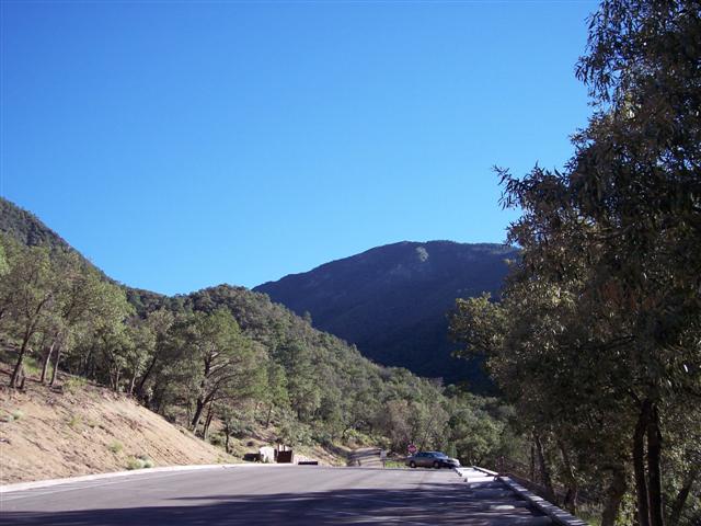
Madera Canyon
John
Madera Canyon
$1LENCE D00600D
Madera Canyon
ALAN SCHMIERER
Madera Canyon
Fredlyfish4
1 / 4

Loading rider experiences…

From riders

Download GPX

Navigate to the foot

Where it bites

Steepest 500 m: 10.6% (km 19.7–20.2).

Road: paved throughout

kmtoavg
1901 m2.4%
2918 m1.7%
3935 m1.8%
4956 m2.2%
5970 m1.8%
6994 m2.0%
71019 m2.3%
81043 m2.3%
91063 m2.1%
101093 m3.1%
111109 m2.3%
121118 m0.7%
131145 m3.0%
141185 m4.4%
151235 m4.5%
161290 m5.2%
171349 m6.1%
181422 m7.3%
191499 m7.3%
201597 m9.4%

What it’s like to ride

Madera Canyon climbs from the high desert grassland outside Green Valley to the end of the road at the base of Mount Wrightson, and for most of its length it barely feels like a climb: a steady couple of percent along a desert ridge with long open views, on pavement in good shape apart from expansion cracks every 15 to 20 feet that you notice far more on the way down. Then the road ducks into the canyon under sycamore and oak, and the shade and the gradient arrive together: the last few miles bite properly, with a half-mile pitch around 10% and a final ramp to the road's end at close to 15%. There is no bike lane anywhere on it, but traffic is genuinely light, which is much of why the pros who come to Tucson rank it their second or third choice after Mount Lemmon. Water and restrooms sit at the lookout about nine miles up, Santa Rita Lodge a mile and a half further on will sell you a Gatorade, and the top at 5,341 feet has restrooms, a campground and Madera Kubo. Watch the road on the descent: deer, coati, snakes and wild turkey all use it.

History

Madera is Spanish for lumber, and the canyon earned the name: a commercial lumber camp worked here in the late 1800s, and a road was cut from the canyon down to the main Tucson to Tubac road to haul the timber out. The Santa Rita Mountains became part of the new National Forest System in 1905, and from 1911 a Tucson businessman and his backers built cabins on land leased from the Forest Service. The roads were improved over the following years, automobiles came into use, and the canyon turned into a summer destination. A Civilian Conservation Corps camp worked the canyon through the 1930s, building a campground, an amphitheater, trails and erosion works, and its largest project was the Mt. Wrightson picnic area at the end of the road at about 4,500 feet, where many of the rock walls they laid still stand. That paved road is now a winter training ground for road cyclists and triathletes, a steady ascent from Green Valley to the base of Mount Wrightson that Tucson riders rank second only to Mount Lemmon among the area's climbs.

Worth stopping near the climb

Madera Canyon<1 kmPosada Java<1 kmTitan Missile Museum6 km

More climbs in Tucson & the Sky Islands

Gates Pass4.2 km · 3.9%Mount Lemmon (Catalina Highway)46.3 km · 3.7%Kitt Peak19.8 km · 5.4%Mount Graham (Swift Trail, AZ-366)34.1 km · 5.2%

Common questions

How long and steep is Madera Canyon?
Madera Canyon is a 20.9 km cycling climb averaging 3.7% (+784 m), rising from 878 m to 1655 m in Tucson & the Sky Islands.
Where is Madera Canyon steepest?
The steepest 500 m averages 10.6%, between km 19.7 and km 20.2 of the climb.
What is the road surface like on Madera Canyon?
Madera Canyon is paved throughout.

Checked 13 August 2026

Part of: The climbs that never turn backPart of: The sting in the tail

Elevation from SRTM (NASA) · Road line + coordinates © OpenStreetMap contributors · Story adapted from Wikipedia and cycling-media reporting, CC BY-SA 4.0 · Photos: Wikimedia Commons, credited per image · Wikidata

Places / Tucson & the Sky Islands / Madera Canyon

20.9 km · +784 m · 3.7% avg · ~10.6% max · 878 → 1655 m

2%2%2%2%2%1%4%5%7%8%2468101214161820km878 m1655 m

Photo: John · © OpenStreetMap contributors · Sources: OpenStreetMap