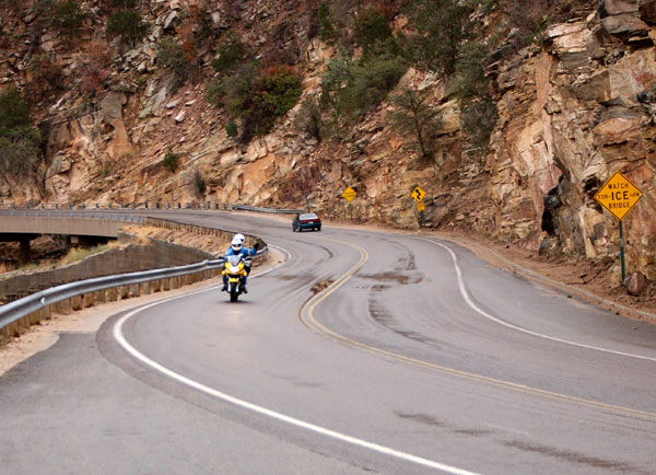
Cycling stops in Tucson & the Sky Islands

26 places · 5 routes · Arizona, United States

Tucson's reputation rests on one road. The Catalina Highway leaves the eastern edge of town at saguaro height and climbs for about forty kilometres to Ski Valley, gaining the better part of 1,800 metres and passing out of the Sonoran Desert into pine forest on the way, a change of vegetation that would otherwise take a drive to Canada. Riders stack up at Le Buzz at the bottom before the climb and at the Cookie Cabin in Summerhaven after it, which is as close as American road cycling gets to a liturgy.

The rest of the riding fans out from there: Gates Pass and the Saguaro West loop to the desert museum, the long straight run south past the Titan silo to Madera Canyon, Kitt Peak's observatory road out on the Tohono O'odham Nation, and the mission of San Xavier del Bac standing white against the desert on the way home. Two hours east, Mount Graham's Swift Trail climbs 34 km into the Pinaleños, the biggest of the sky islands and the region's longest sustained climb. It stays rideable through the winter, which is why the training camps come.

Cafés

Boca Tacos Y TequilaCaféBOCA Tacos y Tequila is a scratch-kitchen Mexican restaurant on Tucson's Fourth Avenue, run by chef Maria Mazon, a Top Chef alum and James Beard Award semifi…El CharroCaféEl Charro Café is a Mexican restaurant in downtown Tucson, run by the same family since 1922 and billed as the nation's oldest continuously operating Mexican…El Güero CaneloCaféEl Güero Canelo is a Tucson institution for Sonoran hot dogs, started in 1993 by Daniel and Blanca Contreras from a small trailer on South 12th Avenue and no…Exo Roast Co.CaféExo Roast Co.Le Buzz CaféCaféLe Buzz Caffe is a breakfast-and-lunch café with a full espresso bar that has served Tucson since 1996, roasting its own coffee and baking its own pastries i…Mt. Lemmon Cookie CabinCaféMt.Posada JavaCaféPosada Java is a coffee shop at The Shoppes at La Posada, run by La Posada at Green Valley as the area's social hub.Presta Coffee RoastersCaféPresta Coffee Roasters is a Tucson specialty coffee roaster, with this location inside Mercado San Agustín, an open-air market on the city's west side.

Climbs, views & nature

Colossal Cave Mountain ParkCaveColossal Cave Mountain Park is built around one of the largest dry caves in North America, a 2,400-acre park southeast of Tucson also home to the 128-year-ol…Gates PassPass · 966 mMountain pass at 3,172 ft through the Tucson Mountains west of the city.Kitt PeakPeak · 2099 mKitt Peak (2,099 m) in Arizona's Sonoran Desert hosts Kitt Peak National Observatory, one of the world's largest collections of optical telescopes.Sabino Canyon Recreation AreaCanyonSabino Canyon Recreation Area lies in the Santa Catalina Mountains, where Depression-era CCC and WPA crews built the tram road, nine bridges over Sabino Cree…Saguaro National Park - Rincon Mountain DistrictNature reserveThe Rincon Mountain District preserves 92,000 acres of Sonoran Desert with giant saguaro cacti and high biodiversity.Saguaro National Park (Tucson Mountain District)National parkThis is the Tucson Mountain District ("Saguaro West") of Saguaro National Park, one of the densest saguaro forests in the Sonoran Desert.Sentinel PeakPeak · 884.2 mA 2,897 ft peak in the Tucson Mountains.

History & landmarks

Arizona State MuseumMuseum · TucsonArizona State Museum, founded 1893, preserves and displays archaeological artifacts from the region.Arizona-Sonora Desert MuseumZoo · TucsonA 98-acre zoo, aquarium, botanical garden, and natural history museum founded in 1952, just west of Tucson.Biosphere 2LandmarkA 3.14-acre enclosed ecosystem built 1987–1991 to test whether humans could survive in a sealed, self-sustaining environment, research aimed at eventual spac…International Wildlife MuseumMuseumThe International Wildlife Museum permanently closed on January 11, 2024, after operating as a natural history museum since 1988.Madera CanyonLandmarkCanyon in the Santa Rita Mountains, 25 miles southeast of Tucson, with hiking trails, picnic areas, and campsites.Mission GardenGardenMission Garden is a walled, four-acre living agricultural museum at the foot of Sentinel Peak, on the site of the Tohono O'odham village of Cuk Ṣon and Tucso…Mission San Xavier del BacPlace of worship · TucsonHistoric Spanish Catholic mission founded in 1692 by Eusebio Kino, located 10 miles south of downtown on the Tohono O'odham Nation San Xavier Indian Reservat…Pima Air & Space MuseumMuseum · TucsonNearly 400 aircraft spread across 80 acres, one of the largest aerospace museums in the world.Saint Augustine CathedralCathedral · TucsonCathedral of Saint Augustine is the mother church of the Catholic Diocese of Tucson, located downtown.Titan Missile MuseumMuseum · SahuaritaCold War ICBM silo south of Tucson, built in 1963 and deactivated in 1984.Tucson Museum of ArtMuseum · TucsonLarge art museum on a four-acre block in downtown Tucson's Presidio District, with 74,000 sq ft of space including 19th-century historic homes adapted for ga…

Climbs

Gates Pass4.2 km · 3.9%Kitt Peak19.8 km · 5.4%Madera Canyon20.9 km · 3.7%Mount Graham (Swift Trail, AZ-366)34.1 km · 5.2%Mount Lemmon (Catalina Highway)46.3 km · 3.7%
CLIMB

Mount Lemmon (Catalina Highway)

Tucson & the Sky Islands

Gradient by colour: under 3% 3–6% 6–9% 9%+

Stats computed from OpenStreetMap and satellite elevation data — approximate.

Mount Lemmon (Catalina Highway) is a 46.3 km cycling climb averaging 3.7% (+1887 m), rising from 814 m to 2548 m in Tucson & the Sky Islands.

The reason most riders come to Tucson: 29 miles from saguaro to pine at a metronomic 4 to 6%, built over 17 years by a rotating workforce of nearly 8,000 federal prisoners, Gordon Hirabayashi among them. Racing arrived in 1968 and never left, and the Cookie Cabin at Summerhaven is the summit ritual.
Mount Lemmon (Catalina Highway)
Debby Kriegel
Mount Lemmon (Catalina Highway)
Joekoz451
Mount Lemmon (Catalina Highway)
Philcomanforterie
Mount Lemmon (Catalina Highway)
Motorrad-67
1 / 4

Loading rider experiences…

From riders

Download GPX

Navigate to the foot

Where it bites

Steepest 500 m: 9.0% (km 45.3–45.7).

Road: paved throughout

kmtoavg
1821 m0.8%
2827 m0.5%
3840 m1.4%
4852 m1.7%
5902 m4.3%
6954 m5.2%
71020 m5.6%
81066 m4.7%
91111 m4.3%
101165 m5.9%
111219 m5.3%
121272 m5.3%
131319 m4.7%
141356 m4.7%
151424 m5.7%
161479 m5.5%
171521 m4.9%
181589 m6.4%
191623 m3.1%
201661 m3.8%
211698 m5.0%
221772 m6.1%
231802 m3.0%
241845 m4.3%
251913 m6.6%
261963 m5.2%
272008 m5.1%
282032 m2.4%
292095 m5.9%
302134 m3.5%
312177 m4.9%
322219 m4.2%
332275 m5.5%
342334 m5.1%
352390 m6.2%
362435 m4.4%
372485 m5.5%
382488 m0.3%
392451 m-3.3%
402400 m-5.3%
412383 m-2.4%
422433 m3.8%
432443 m1.2%
442412 m-2.8%
452458 m4.7%
462539 m8.1%

What it’s like to ride

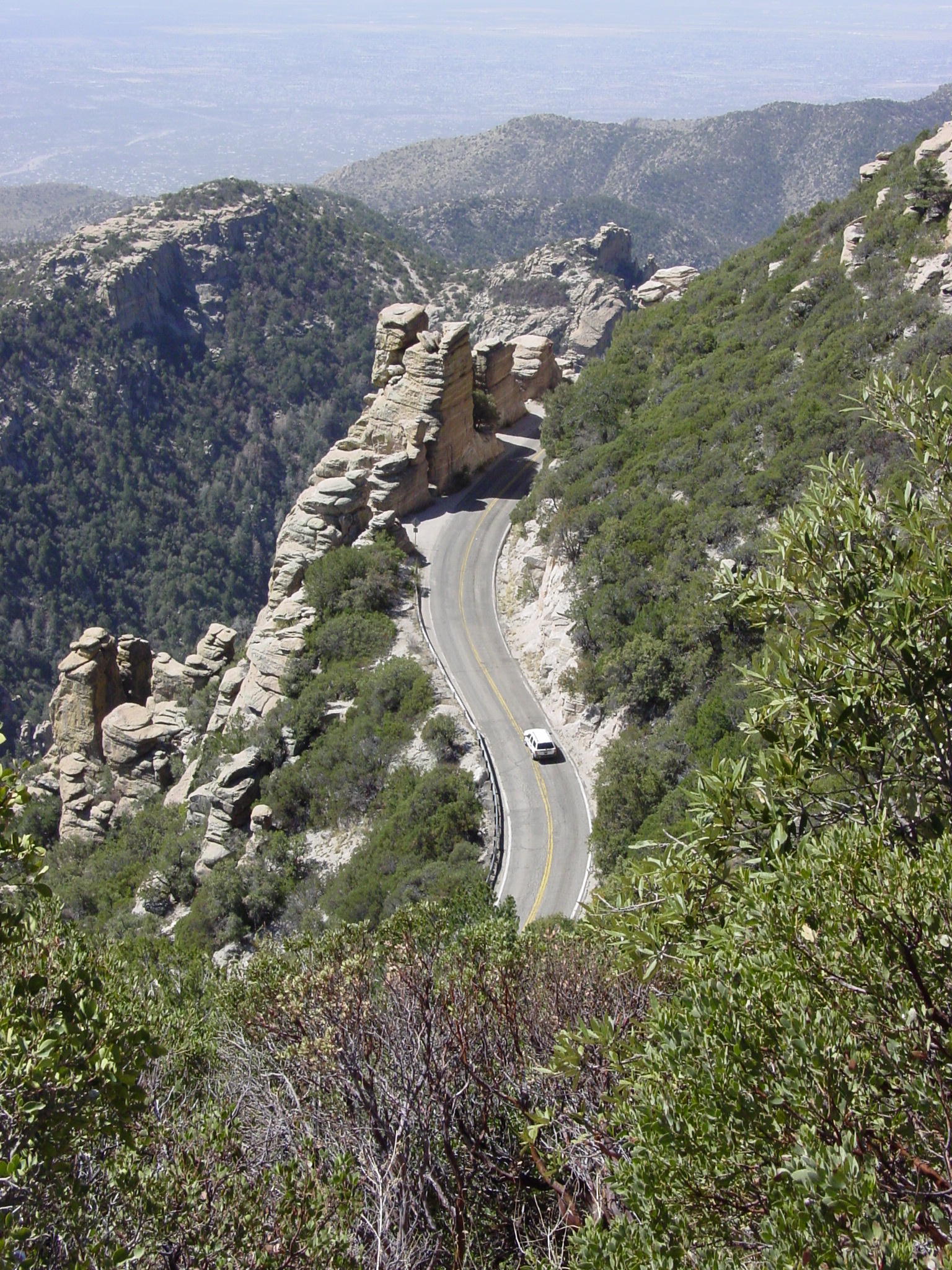
Most riders start from Le Buzz café at the corner of Tanque Verde and Catalina Highway, and from there it is close to 29 miles of continuous road, from saguaro forest at about 2,600 feet to above 9,000, averaging around 4.2%. The character is metronomic rather than brutal: a steady 4 to 6% almost the whole way on smooth tarmac with a wide shoulder, and mile markers posted from zero to 23 so you can tick off progress in one gear. Windy Point at mile 14.7 is where everyone stops, granite pinnacles and hoodoos on both sides, and the rock sculptures keep coming for a few more miles while the cactus gives way to pine and the air turns 20 to 30°F cooler than the town you left. Carry what you need low down, because there is no water until the Bigelow trailhead past mile marker 19. Near the top the road gives some height back, dropping 2.1 miles at 4.2% from mile 21.2 and again briefly before the right turn onto Ski Run Road, where the last 2.6 miles kick up to 8.1%. Summerhaven at the top has food and shelter, and the Cookie Cabin, open 11 to 5, sells cookies the size of a paper plate.

History

Frank Harris Hitchcock, publisher of the Tucson Citizen and a former US Postmaster General, pushed for a short road from Tucson up into the Santa Catalina high country, and work began in 1933. Federal prisoners built it: a rotating workforce of nearly 8,000 men housed at Prison Camp No. 10, later the Catalina Federal Honor Camp, who started with picks, shovels and wheelbarrows and who during the Second World War included Japanese American draft resisters, among them Gordon Hirabayashi. Construction ran 17 years and reached Summerhaven in 1950, the camp closing in 1951 once the road was done; the highway carries Hitchcock's name, given after his death in 1935. The narrow original was rebuilt between 1988 and 2007 in seven Federal Lands Highway projects worth about $15 million, adding the wider shoulders and guard rails riders use now, and the redesign won Arizona's Engineering Excellence Grand Award for Context Sensitive Design in 2005. Racing arrived on 28 April 1968, when riders from Phoenix and Tucson took on 31 miles from the edge of town to the observatory: local law enforcement halted the pack and ordered single file with no passing, the race resumed once the officers left, and Mike Keller won in 2 hours 20 minutes. The Greater Arizona Bicycling Association now runs its annual Mt. Lemmon Hill Climb up the same road, from McDonald Park to Ski Valley.

Worth stopping near the climb

Mt. Lemmon Cookie Cabin2 kmLe Buzz Café3 kmSabino Canyon Recreation Area6 km

More climbs in Tucson & the Sky Islands

Gates Pass4.2 km · 3.9%Madera Canyon20.9 km · 3.7%Kitt Peak19.8 km · 5.4%Mount Graham (Swift Trail, AZ-366)34.1 km · 5.2%

Common questions

How long and steep is Mount Lemmon (Catalina Highway)?
Mount Lemmon (Catalina Highway) is a 46.3 km cycling climb averaging 3.7% (+1887 m), rising from 814 m to 2548 m in Tucson & the Sky Islands.
Where is Mount Lemmon (Catalina Highway) steepest?
The steepest 500 m averages 9.0%, between km 45.3 and km 45.7 of the climb.
What is the road surface like on Mount Lemmon (Catalina Highway)?
Mount Lemmon (Catalina Highway) is paved throughout.

Checked 13 August 2026

Part of: The vertical kilometre clubPart of: Roads built as statementsPart of: The climbs that never turn backPart of: Roads to the telescopes

Elevation from SRTM (NASA) · Road line + coordinates © OpenStreetMap contributors · Story adapted from Wikipedia and cycling-media reporting, CC BY-SA 4.0 · Photos: Wikimedia Commons, credited per image

Places / Tucson & the Sky Islands / Mount Lemmon (Catalina Highway)

46.3 km · +1887 m · 3.7% avg · ~9.0% max · 814 → 2548 m

1%4%5%5%5%5%4%5%6%4%5%5%0%0%1%51015202530354045km814 m2548 m

Photo: Debby Kriegel · © OpenStreetMap contributors · Sources: OpenStreetMap