Stationsberg
Flanders
Gradient by colour: under 3% 3–6% 6–9% 9%+
Stats computed from OpenStreetMap and satellite elevation data — approximate.
Stationsberg is a 0.8 km cycling climb averaging 2.1% (+16 m), rising from 39 m to 55 m in Flanders.
The 1860s station road the classics ride in both directions: E3 climbs it, the Ronde descends it off the Steenbeekdries as the tail of the 2.4 km Mariaborrestraat sector. Protected since 1995, relaid in 2026.
 LimoWreck
 LimoWreck
 Van der Linden, Geert
 Van der Linden, Geert
Loading rider experiences…
Download GPX
Navigate to the foot
Where it bites
Steepest 100 m: 9.3% (km 0.2–0.3).
Road: cobbled throughout
| section | to | avg |
|---|
| 0–100 m | 40 m | 0.9% |
| 100–200 m | 43 m | 2.5% |
| 200–300 m | 49 m | 9.2% |
| 300–400 m | 50 m | 1.2% |
| 400–500 m | 51 m | 0.8% |
What it’s like to ride
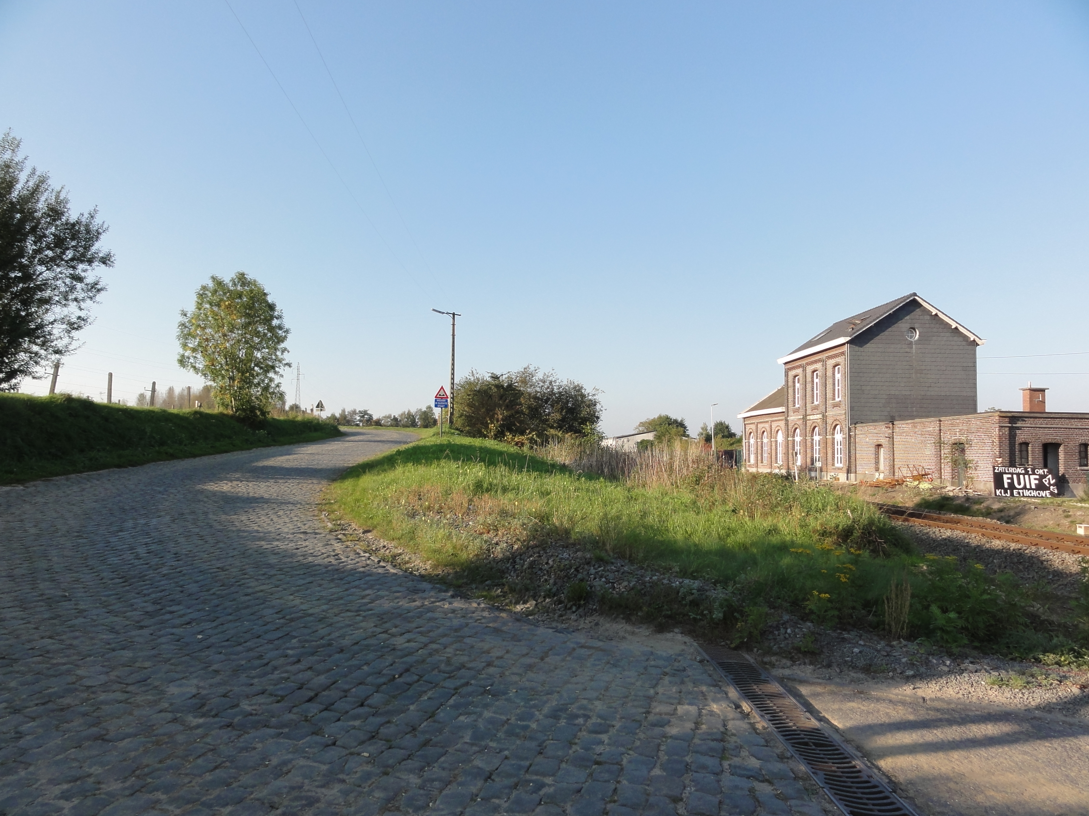
The Stationsberg is a cobbled connecting road from the 1860s, running west out of the Nederholbeekstraat up to the Steenbeekdries. The foot is the part you remember: the road crosses the Oudenaarde to Ronse railway and kinks through an elbow that opens into a long irregular square beside Etikhove station, a building put up in 1861, closed to passengers in 1984 and still standing among nineteenth century houses and a couple of former inns. Above that it straightens, and the stones do the work here, poorly laid enough that holes in the descent had to be filled before the 2003 Ronde. At the top you turn right and the Steenbeekdries drops away, which is how the E3 rides it, while the Ronde van Vlaanderen goes round the other way, climbing the Steenbeekdries and descending the Stationsberg toward the Taaienberg or Ronse. Taken together, Mariaborrestraat, Steenbeekdries and Stationsberg make one 2.4 km strip of pavé, and the blue loop of the waymarked Ronde van Vlaanderenroute uses it as a descent too. The cobbles have been a protected monument since 1995 and were relaid in 2026, the link down from the Steenbeekdries finishing a month or two after that year's race.
History
Stationsberg was laid out in the 1860s as a connecting street between the Nederholbeekstraat and the Steenbeekdries, after the Oudenaarde to Ronse railway line came into use in 1861. It bends around Etikhove station, where the first cobbled stretch widens into an irregular little square beside the level crossing, and the road was protected as a monument on 30 March 1995. Two of the Flemish classics take it in opposite directions: the E3 at Harelbeke climbs it, in 2015 as one of four bergs in quick succession between the Eikenberg and the Taaienberg, while the Ronde van Vlaanderen descends it as the closing stretch of the 2,400 metre cobbled sector the race lists under the name Mariaborrestraat. That descent has needed looking after, with potholes filled in 2003 to keep the Ronde safe across it. Maarkedal filed a restoration dossier in 2013 and the Flemish government awarded 1,331,099.88 euro in 2019 to rebuild the protected cobbles of the Mariaborrestraat, Steenbeekdries, Stationsberg and Eikenberg, work that saw the streets relaid in 2026.
Common questions
- How long and steep is Stationsberg?
- Stationsberg is a 0.8 km cycling climb averaging 2.1% (+16 m), rising from 39 m to 55 m in Flanders.
- Where is Stationsberg steepest?
- The steepest 100 m averages 9.3%, between km 0.2 and km 0.3 of the climb.
- Is Stationsberg cobbled, and for how far?
- Yes. 0.7 km of Stationsberg's 0.8 km are laid in sett or cobblestone (cobbled throughout), measured from OpenStreetMap surface tags along the climb.
0.8 km · +16 m · 2.1% avg · ~9.3% max · 39 → 55 m